Get to know Bombinhas: the complete guide to the peninsula
Geography, history, the 39 beaches, diving in the Arvoredo Reserve, trails, when to go and how to get there — everything about Santa Catarina's smallest town, in a single guide.
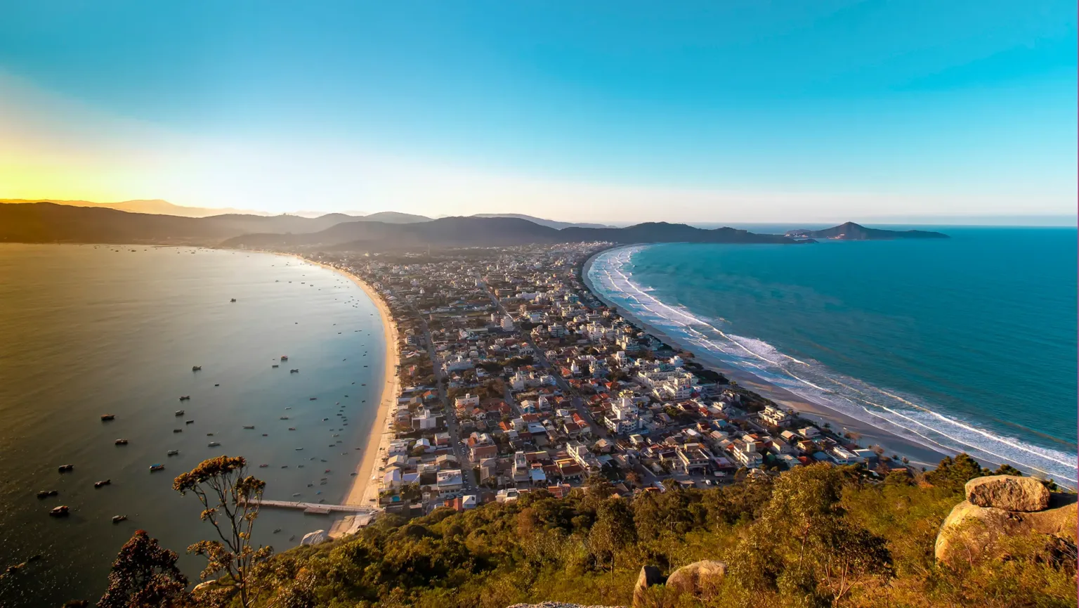
Bombinhas covers 35 km² — it is the smallest town in Santa Catarina by area — and within them it hides 39 beaches, Atlantic Forest headlands and the clearest water on the southern coast. It is little land for so much landscape. Perhaps that is why the peninsula became, at once, Brazil's national capital of ecological diving and one of the country's most sought-after places to trade the big city for the sea.
This guide gathers in one place what is usually scattered across dozens of pages: where Bombinhas is, how it became what it is, which beaches match your travel style, where to dive, when to go and how to get there. It is long on purpose — the idea is that you won't need to open another tab.
In Bombinhas, the distance between a rough open-sea beach and a still natural pool is often a ten-minute trail.
Where it is — and why it's different
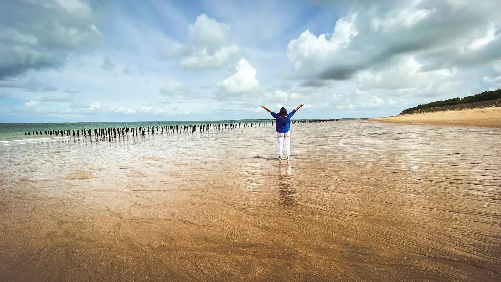
Bombinhas sits at the tip of a peninsula on the North Coast of Santa Catarina, next to Porto Belo and about 12 km from the BR-101 highway. That shape — land surrounded by sea on three sides — is what explains the variety: in just a few kilometres you go from open, surf-worthy beaches to sheltered coves where the sea barely breaks.
That's 39 beaches in 35 km². The town holds five international seals for environmental quality and water cleanliness — among them the Blue Flag, at Quatro Ilhas — and keeps much of its territory covered by preserved Atlantic Forest. In summer it welcomes more than two million visitors; out of season, it goes back to being a fishing village with schools, shops and silence.
A bit of history
Before the maps, the peninsula was home to the Carijó people. Azorean colonisation began around 1735: arriving from the Azores, the newcomers favoured the hillsides, where they could farm, and left fishing as a heritage that has crossed centuries — to this day the artisanal mullet fishing in winter is part of the local identity.
Bombinhas only became a town recently. On 15 March 1992, a plebiscite decided its emancipation from Porto Belo, and the municipality was created by State Law no. 8,558 of 30 March that year. To get to know that origin up close, visit the Engenho do Sertão Community Museum, set in an old mill, which keeps the region's Azorean memory alive.
The beaches, by profile
The right question in Bombinhas isn't "which is the best beach", but "what kind of day do you want". Here's one way to choose:
| You want… | Go to | Why |
|---|---|---|
| Snorkelling and still water | Sepultura, Lagoinha | Natural pools, fish in sight |
| Surf and open sea | Mariscal, Quatro Ilhas | Waves and a wide stretch of sand |
| Quiet and seclusion | Tainha, Retiro dos Padres | Reached by trail, almost always empty |
| Amenities and buzz | Bombas, Centre | Kiosks, shops and easy access |
| Calm sea with a hill view | Conceição | At the foot of Morro do Macaco |
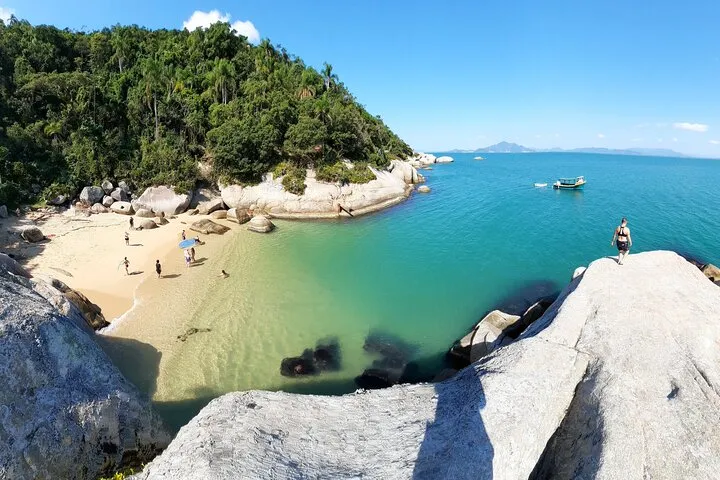
Sepultura
Just over 90 metres of sand and a sea without waves: Sepultura is the most famous natural pool on the peninsula and the best place for your first-ever snorkel. Along the headlands it's common to meet sea turtles and even seahorses. The name comes from a 19th-century legend.
](/home/bombinhas-2.webp)
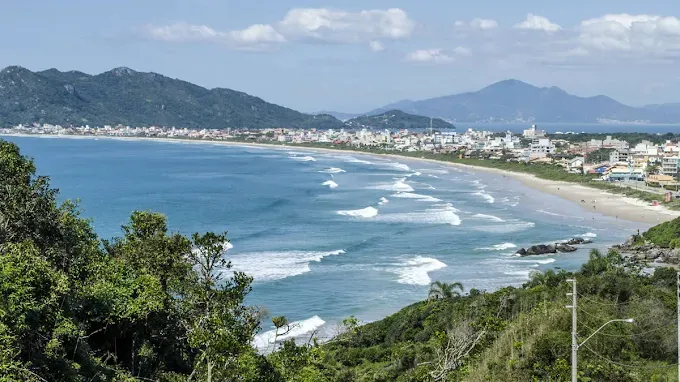
Mariscal
Four kilometres of preserved sandbank and quartz-crystal sand — the longest beach in Bombinhas, with waves that please surfers. The name comes from the shellfish ("marisco") clinging to the rocks of the headlands.
Quatro Ilhas
A little over a kilometre of sand with four islands drawn on the horizon — hence the name. It's one of the beaches awarded the Blue Flag, the international seal given to beaches with clean water and good amenities.
Tainha
At the southern tip of the peninsula, surrounded by Atlantic Forest and reached by a roughly 45-minute trail, Tainha is the reward for those willing to walk: artisanal fishing, silence and, with luck, dolphins and whales passing offshore.
](/home/bombinhas-1.webp)
Diving capital
The nickname is no brochure exaggeration. A few kilometres off the coast lies the Arvoredo Marine Biological Reserve, a federal fully-protected unit created in 1990, with about 17,600 hectares and the islands of Arvoredo, Galé, Deserta and the Calhau de São Pedro. It's one of the best diving spots in Brazil — in summer, visibility reaches 15 metres deep.
And you don't need to be a diver. On a discovery dive, local operators give you a quick pool briefing and take you out to sea with an instructor — spots like Saco do Batismo, Baía das Tartarugas and Saco do Capim are classics for a first time.
](/home/bombinhas-3.webp)
Trails and viewpoints
To take in the whole peninsula at once, there are two paths side by side, in the Morro do Macaco Municipal Park:
- Morro do Macaco, 191 metres high with a 360° view, reached by a roughly 1.2 km trail (30 to 40 minutes).
- The Eco 360° Viewpoint, a neighbouring attraction with three lookouts, a natural history museum and a 170-metre zipline — the final climb takes about 15 minutes.
To get a feel for the climb before you take it on, the video below is Hian doing the Morro do Macaco trail in the late afternoon:
What to bring for a day of trails and headlands:
- Water and reapplicable sunscreen
- Trail shoes (several headlands have loose rock)
- Mask and snorkel
- Cash for stalls and the fish market
When to go
Each season delivers a different Bombinhas:
| Season | What it's like |
|---|---|
| Summer (Dec–Feb) | High season, peaking in January: packed beaches, heat and buzz |
| Autumn (Mar–May) | Mild weather, fewer people, great value |
| Winter (Jun–Aug) | Dry and cool, clearer water, mullet fishing and low prices |
| Spring (Sep–Nov) | Gradual reopening, warming sea, calm |
How to get there
Bombinhas has no airport of its own, but it's close to two:
- Navegantes (NVT) — about 60 km, the nearest.
- Florianópolis (FLN) — about 80 km.
From either, the route is the BR-101 to the Porto Belo exit (KM 155) and from there the SC-412 to the peninsula. A car is the most practical way to move between beaches — many are reached only by narrow road or trail.
What to eat
The cuisine is of the sea, with an Azorean accent. Three things not to miss:
- Shrimp sequence — the signature dish: breaded, grilled and garlic-and-oil shrimp, served in rounds.
- Charcoal-grilled mullet — from May to July, grilled at the fishing huts by the beach, at the height of the season.
- Seafood stew — fish, shrimp, squid and mussels in the same broth.
To live there, not just visit
There's a difference between spending a week in Bombinhas and having the peninsula as your address. Those who visit rush to make the most of everything; those who live there choose the right hour for each beach, every day, without haste. It's that relationship with the place — the sea nearby, at the pace of those who stay — that guides every HY project.
Want to get to know the developments born from this philosophy? We'll show you everything over WhatsApp, no strings attached.